Enterprise geofencing and asset tracking have moved beyond simple dots on a map. Large organizations now expect real-time visibility, configurable security controls, predictive analytics, and integrations with workforce, fleet, warehouse, and enterprise resource planning systems. The vendor landscape is broad, ranging from fleet telematics specialists to indoor positioning providers, cloud location platforms, and full industrial IoT suites.
TLDR: Enterprise-grade geofencing and asset tracking vendors differ most in coverage model, hardware ecosystem, analytics depth, and integration flexibility. Fleet-focused platforms such as Samsara, Geotab, and Verizon Connect emphasize vehicles, drivers, compliance, and route intelligence, while providers such as Zebra, Kontakt.io, and Cisco Spaces are stronger for indoor assets and facilities. Cloud and mapping platforms such as AWS Location Service, Azure Maps, HERE, Radar, and Esri offer flexible geospatial building blocks for organizations with development resources. The best choice depends on whether the business needs turnkey operations, custom location intelligence, indoor precision, regulatory-grade reporting, or global scalability.
What Enterprise-Grade Geofencing Really Means
At an enterprise level, geofencing is not just the creation of a virtual boundary around a site, vehicle yard, construction zone, retail location, port, hospital department, or distribution center. It involves policy-driven automation: alerts, workflows, access rules, compliance logs, route deviations, dwell-time measurements, and security escalations triggered by location events.
Asset tracking extends that capability by identifying the position and status of vehicles, equipment, containers, tools, inventory, medical devices, trailers, pallets, or personnel badges. Depending on the use case, tracking may rely on GPS, cellular, WiFi, Bluetooth Low Energy, RFID, Ultra Wideband, satellite, LoRaWAN, or hybrid positioning. Enterprise vendors usually combine these signals with dashboards, APIs, mobile applications, analytics engines, and integrations.
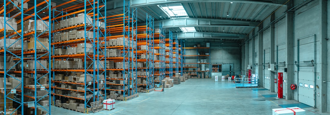
Image not found in postmetaCore Vendor Categories
The market can be compared through several major categories. Each category serves a different operational profile and should be evaluated according to deployment environment, accuracy requirements, refresh rate, device management, and governance standards.
- Fleet telematics vendors: Samsara, Geotab, Verizon Connect, Motive, Trimble, and Fleet Complete typically focus on vehicles, drivers, fuel, maintenance, ELD compliance, and dispatch operations.
- Indoor asset tracking providers: Zebra Technologies, Kontakt.io, CenTrak, AiRISTA, HID, and Cisco Spaces often serve hospitals, warehouses, campuses, factories, and corporate facilities.
- Cloud location platforms: AWS Location Service, Azure Maps, Google Maps Platform, HERE Technologies, Mapbox, and Radar provide APIs, geocoding, routing, geofencing, and location data infrastructure.
- Industrial IoT and supply chain platforms: Oracle, SAP, IBM, PTC, Honeywell, and Siemens support broader asset lifecycle, manufacturing, maintenance, and logistics intelligence.
- GIS and spatial analytics platforms: Esri ArcGIS and similar platforms are suited for organizations requiring advanced mapping, spatial modeling, territory planning, and geospatial analysis.
Real-Time Visibility: Speed, Accuracy, and Context
Real-time visibility is often the primary reason enterprises invest in geofencing and asset tracking. However, real time has different meanings. For a long-haul truck, updates every 30 to 60 seconds may be sufficient. For a forklift moving through a distribution center, sub-second or near-real-time indoor signals may be required. For cold-chain pharmaceuticals, location must be paired with temperature, humidity, shock, and chain-of-custody data.
Samsara is widely recognized for strong fleet visibility, video telematics, driver behavior data, and operational dashboards. It suits logistics, field services, construction, and transportation teams that want a modern hardware-software combination. Geotab is notable for its open ecosystem, marketplace, data flexibility, and strong diagnostics. It is often selected by large fleets needing customizable reporting and broad vehicle compatibility. Verizon Connect provides mature fleet tracking, route optimization, mobile workforce tools, and enterprise service coverage, making it attractive to organizations already aligned with Verizon’s connectivity ecosystem.
For asset-heavy indoor environments, Zebra Technologies offers a broad set of RFID, barcode, mobile computing, and warehouse visibility tools. Kontakt.io focuses on Bluetooth-based indoor IoT, commonly used for occupancy, location services, and asset tracking in buildings. Cisco Spaces leverages WiFi infrastructure and location analytics, especially in campuses, retail, healthcare, and corporate spaces where Cisco networking is already deployed.
Security and Governance Capabilities
Enterprise buyers increasingly treat location data as sensitive information. Asset tracking systems can reveal shipment value, workforce movement, facility layouts, operational bottlenecks, and customer locations. As a result, vendors must be assessed on identity management, encryption, access control, audit trails, data retention, device security, and compliance certifications.
Cloud platforms such as AWS Location Service and Azure Maps benefit from enterprise-grade cloud security models, including IAM controls, encryption, regional data residency options, monitoring, and integration with broader security tooling. These platforms are often preferred when organizations want to build custom geofencing workflows while keeping governance aligned with existing cloud policies.
Turnkey fleet vendors typically provide role-based access, driver permissions, device administration, and alert histories. However, security depth can vary by plan, region, and integration design. Enterprises should examine whether vendors support single sign on, multifactor authentication, API access controls, granular data permissions, and tamper detection. For high-value assets, device-level security is especially important because trackers may be removed, shielded, spoofed, or physically damaged.

Operational Intelligence and Analytics
The strongest platforms do more than show where an asset is; they explain what the location pattern means. Operational intelligence may include route adherence, dwell time, utilization rates, idle time, unauthorized movement, yard congestion, delivery exceptions, maintenance predictions, and labor productivity patterns.
Trimble has deep roots in transportation, construction, agriculture, and field operations, making it useful where location intelligence intersects with physical workflows and specialized equipment. Honeywell and Siemens often appear in industrial contexts where asset monitoring connects with automation, safety, and plant operations. Oracle and SAP are relevant when asset events need to feed procurement, inventory, finance, maintenance, and supply chain execution systems.
Esri ArcGIS remains a leader when spatial analysis is central. Public sector agencies, utilities, telecommunications companies, emergency services, and infrastructure owners may rely on Esri for layered maps, field data collection, territory analysis, risk modeling, and geospatial dashboards. It may not be the fastest path to basic fleet tracking, but it is powerful for organizations that treat location as a strategic analytical layer.
Comparison of Leading Vendor Strengths
| Vendor Type | Typical Strengths | Best Fit | Potential Limitation |
|---|---|---|---|
| Fleet telematics | Vehicle tracking, driver behavior, dispatch, compliance, maintenance | Transportation, construction, field service, logistics | May be less precise indoors or for non-vehicle assets |
| Indoor positioning | Room-level or zone-level asset visibility, badges, tags, facility analytics | Hospitals, warehouses, factories, campuses | Infrastructure planning and calibration may be required |
| Cloud location APIs | Custom geofencing, routing, maps, developer flexibility, scalable infrastructure | Enterprises building proprietary applications | Requires engineering resources and solution design |
| Industrial IoT suites | Asset lifecycle, maintenance, sensors, automation, ERP integration | Manufacturing, energy, utilities, supply chain | Implementation can be complex and costly |
| GIS platforms | Spatial analytics, layered mapping, field operations, risk modeling | Government, utilities, telecom, infrastructure | May require GIS expertise for maximum value |
Integration and Ecosystem Considerations
No enterprise asset tracking platform operates in isolation. The value increases when location events flow into ERP, WMS, TMS, CRM, CMMS, SIEM, business intelligence, and incident management systems. Vendors with mature APIs, webhooks, SDKs, data export tools, and marketplace integrations usually reduce implementation friction.
Geotab is frequently praised for its ecosystem and extensibility. Samsara provides a strong developer platform and integrations for operations teams. Esri integrates well with geospatial and field service environments. AWS, Azure, HERE, Mapbox, and Google Maps Platform give developers building blocks rather than a fixed operational application. Zebra and Honeywell are strong where tracking must connect to scanning, mobility, warehouse automation, and frontline workflows.
Enterprises should also consider device lifecycle management. Battery replacement, firmware updates, SIM management, tag provisioning, mounting methods, environmental ruggedness, and warranty coverage can determine whether a technically sound system remains viable at scale.
Cost Models and Deployment Trade-Offs
Vendor pricing generally combines hardware costs, subscription fees, data usage, implementation services, and support tiers. Fleet systems often charge per vehicle or device per month. Indoor tracking may charge by tag, gateway, location engine, facility size, or software module. Cloud location platforms may bill by API request, geofence evaluation, map tile, tracking event, or data storage.
A low monthly price may not equal the lowest total cost. Organizations should account for installation labor, network upgrades, calibration, integration work, training, downtime, support responsiveness, and device replacement. In regulated industries, auditability and data retention may be worth paying more for because failures can create legal or operational exposure.
How Enterprises Should Select a Vendor
A structured evaluation should begin with business outcomes rather than technology features. The organization should define whether the main goal is theft reduction, faster dispatch, compliance, improved asset utilization, customer delivery visibility, facility safety, inventory accuracy, or predictive maintenance.
- For fleet-heavy operations: Samsara, Geotab, Verizon Connect, Motive, Trimble, and Fleet Complete should be compared on vehicle diagnostics, driver tools, compliance, video, routing, APIs, and support coverage.
- For indoor asset visibility: Zebra, Kontakt.io, CenTrak, AiRISTA, HID, and Cisco Spaces should be examined for accuracy, infrastructure needs, tag battery life, and workflow automation.
- For custom digital products: AWS Location Service, Azure Maps, HERE, Google Maps Platform, Mapbox, and Radar may provide the greatest flexibility.
- For operational transformation: Oracle, SAP, Honeywell, Siemens, IBM, PTC, and Esri may be better when asset tracking is part of a larger enterprise system.
The most successful deployments usually start with a pilot that includes real users, real assets, difficult coverage zones, integration testing, alert tuning, and security review. After the pilot, the organization can quantify improvements in utilization, recovery time, route efficiency, safety incidents, labor productivity, and customer satisfaction.
Conclusion
Enterprise-grade geofencing and asset tracking vendors are not interchangeable. Some deliver turnkey visibility for fleets, some specialize in indoor precision, some provide developer-first geospatial infrastructure, and others connect asset movement to broader industrial or enterprise intelligence. The right platform is the one that aligns location accuracy, security governance, integration depth, operational analytics, and total cost with the organization’s assets and workflows.
As location data becomes a core operational signal, leading organizations are likely to treat geofencing not as a standalone feature but as part of a wider intelligence layer. That layer will connect people, places, equipment, inventory, routes, risks, and business decisions in near real time.
FAQ
- What is enterprise-grade geofencing?
- Enterprise-grade geofencing uses virtual boundaries to trigger alerts, workflows, reports, and security actions at scale. It usually includes integrations, role-based access, audit logs, analytics, and support for many users, assets, and locations.
- Which vendors are best for fleet tracking?
- Samsara, Geotab, Verizon Connect, Motive, Trimble, and Fleet Complete are commonly evaluated for fleet tracking. The best option depends on compliance needs, vehicle types, video requirements, integrations, and geographic coverage.
- Which vendors are best for indoor asset tracking?
- Zebra Technologies, Kontakt.io, CenTrak, AiRISTA, HID, and Cisco Spaces are often considered for indoor tracking. Selection depends on accuracy requirements, building infrastructure, tag battery life, and operational workflows.
- Are cloud location platforms the same as asset tracking platforms?
- No. Cloud platforms such as AWS Location Service, Azure Maps, HERE, Mapbox, and Google Maps Platform provide APIs and infrastructure for building location applications. Turnkey asset tracking platforms usually include devices, dashboards, alerts, and operational tools out of the box.
- What security features should enterprises require?
- Enterprises should look for encryption, single sign on, multifactor authentication, role-based permissions, audit trails, API security, device tamper detection, data retention controls, and compliance documentation.
- How should an organization choose the right vendor?
- The organization should define the business outcome, test real-world coverage, evaluate integrations, review security, calculate total cost of ownership, and run a pilot before full deployment.